
Development and implementation of a remote sensing-based forest ecosystem monitorings
Motivation:
In recent years the effects of climate change on German forests have become evident due to numerous dry summers. These changes also apply to the Bavarian Forest National Park. For example, the average temperature in March has increased by more than 3 °C and instead of one summer day per year during the 1970s, up to 40 are recorded at present. These rapid changes also lead to the extensive transformation of forests. Therefore, it is of great importance to monitor forest condition and development continuously and more frequently.
National parks are very important when it comes to long-term monitoring of the environment, as these protected zones are allowed to develop naturally without human influence over large areas. This makes them suitable for detecting changes resulting from climate change only. The Bavarian Forest National Park hereby represents an ideal study area for the long-term monitoring of forest ecosystems, as many high-resolution remote sensing datasets were acquired in recent years within the framework of the "Remote Sensing Data Pool". Concomitant to this, extensive ground data on forest structure was recorded at continuous observation plots and trough inventories since the establishment of the national park to address a wide range of research questions.
Based on the analysis and results of this project, management strategies can be developed aiming to protect and conserve the forests. This also makes the project important for the management of commercial forests, as it provides essential knowledge supporting forest science and silvicultural practices.
Objectives:
This project aims to develop concepts for linking remote sensing data techniques with ground data from forest inventories and monitoring sites, enabling the detection of characteristics, that cannot be derived from remote sensing data exclusively. These include metrics on biodiversity such as vegetation density, biomass, phenology, photosynthetic activity, as well as forest structural parameters (e.g., tree height, diameter and age, tree species distribution, wood volume and forest regeneration). All these metrics should be acquired and modelled at present time as well as in retrospective. For referencing purposes, new ground data are generated in addition to the one available through past projects. The resulting datasets are then evaluated regarding forest development in the context of current forest damage issues and the needs of the national park management. The generated products on biodiversity and forest structure are managed to be easily accessible to users and will also support further research projects of the national park.
Finally, the developed workflow is not limited to the Bavarian Forest National Park, but can also be applied in cooperation with other national parks on their respective areas.
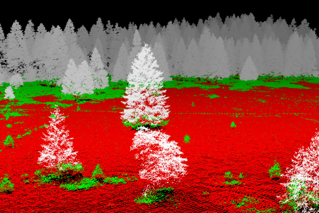
Point Clouds generated using ground-based laserscanning systems depict the structure of forests even below the canopy with high precision. This can be seen impressively in the 3D point cloud video on our YouTube channel.
Methods:
The already existing extensive ground data on forest structure and biodiversity will be extended and brought up to date by conducting new surveys. To be most efficient in terms of time and costs, the implementation of forest inventories using classical methods will be avoided as far as possible. Instead, the 3-D structure of the forest will be recorded with high precision on representative points and areas using a mobile laser scanning system. These data will be merged with laser scanning and high-resolution multi- and hyperspectral data acquired using UAVs and aircrafts, enabling extrapolation to the entire area of the national park. These data will also be re-recorded so that current reference data is available to calibrate acquisitions from past time steps.
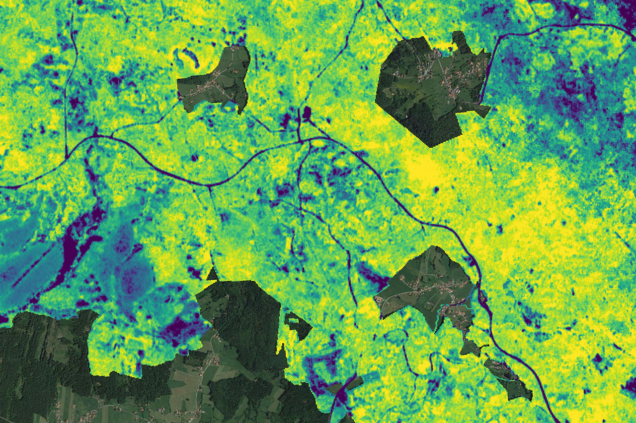
To implement a long-term and temporally dense monitoring, data originating from the ground and airborne surveys will be fused with data from various satellite-based systems featuring multispectral, thermal, hyperspectral, RaDAR, and LiDAR sensors. In particular, the freely available satellite data of the European and American space agencies ESA and NASA will be used. In addition, high-resolution satellite images will be acquired to be able to observe parameters on smaller scales, like the phenology of different tree species. Concerning long-term observations, the satellites of the Landsat program can be used, which offer continuous data since 1972 - almost since the founding of the national park.
Contact persons:
Prof. Dr. Marco Heurich
Head of department
Marco.Heurich@npv-bw.bayern.de
